The Parish Church
This is the 1st of 2 chapters about the churchyard in Bradford On Avon in 1011.
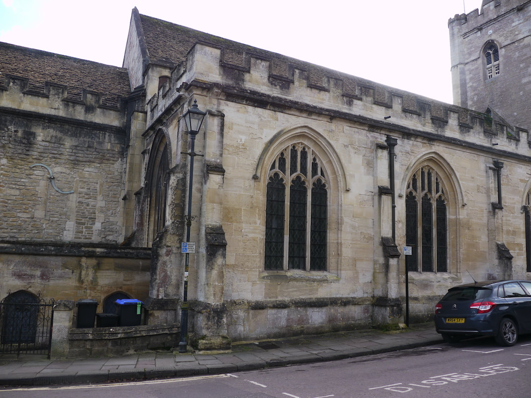
Below is a view I really like of the priests house. Which I'll discuss more in the next chapter about the church of St Laurence. But in this 1st part, we're looking at the parish church.
Below is a view I really like of the priests house. Which I'll discuss more in the next chapter about the church of St Laurence. But in this 1st part, we're looking at the parish church.

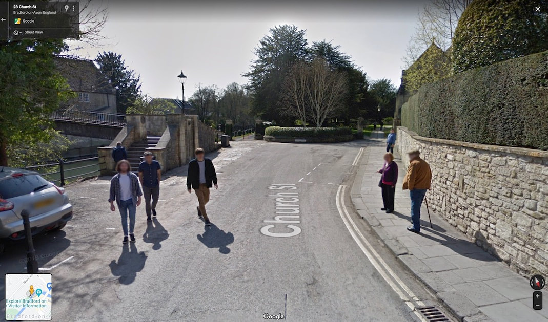
Below, the Google street view image shows the footbridge to St Margaret's hall, and in the back ground the entrance to the current churchyard.
Below that, is a picture of how I think the same area looked in 1011.
Below that, is a picture of how I think the same area looked in 1011.
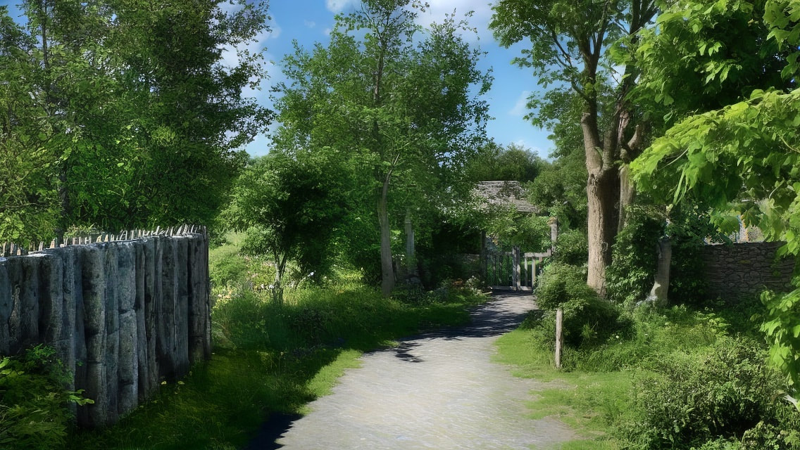
Above on the left, is the high fence of the port, and slightly to the right of the middle, among the strong summer shadows, we can just about see the church gate. Which is closer to us in the 1011 image than in the image of today, as in 1011 the church yard was larger.
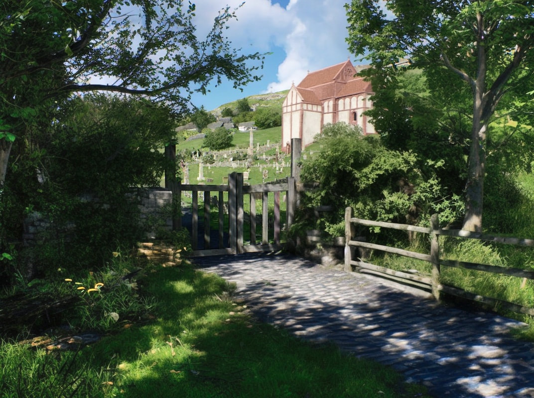
Above is a closer view of the churchyard gate, with the Saxon church (Church of St Laurence) beyond.
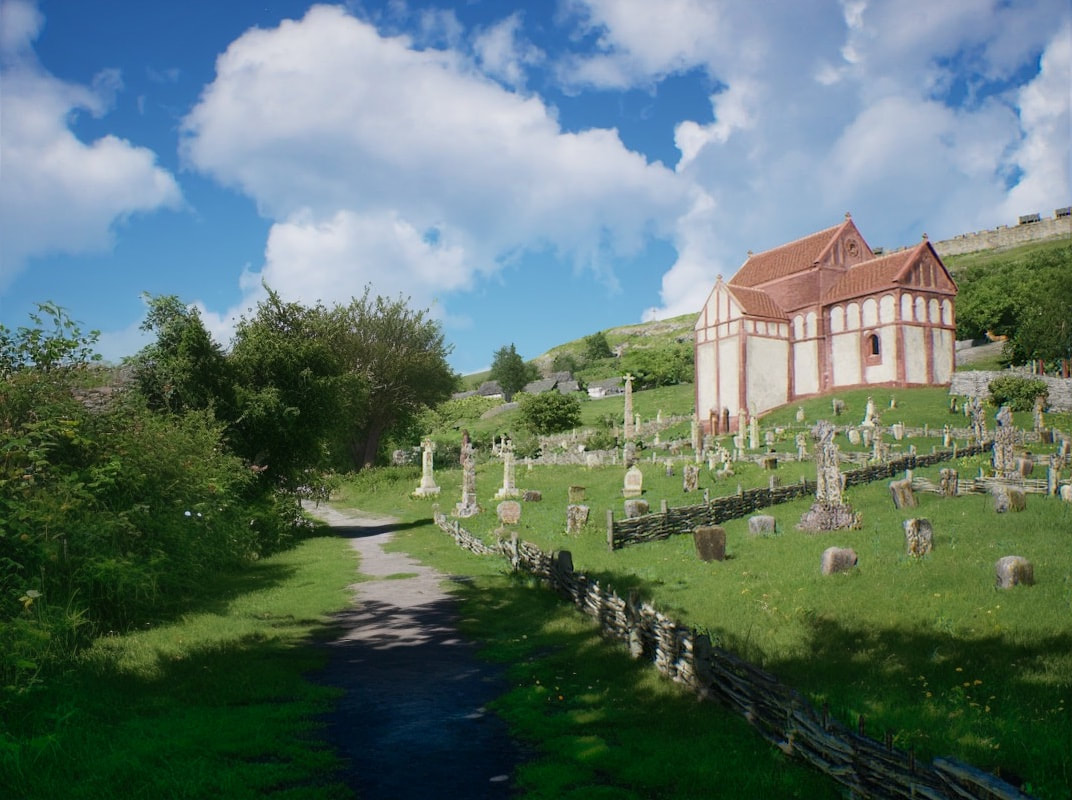
Above, we've come through the gate, as we follow the path on to the parish church.

Above further along the path we see a glimpse of the parish church behind the yew tree, but before we see it, off to the right there's something quite interesting.
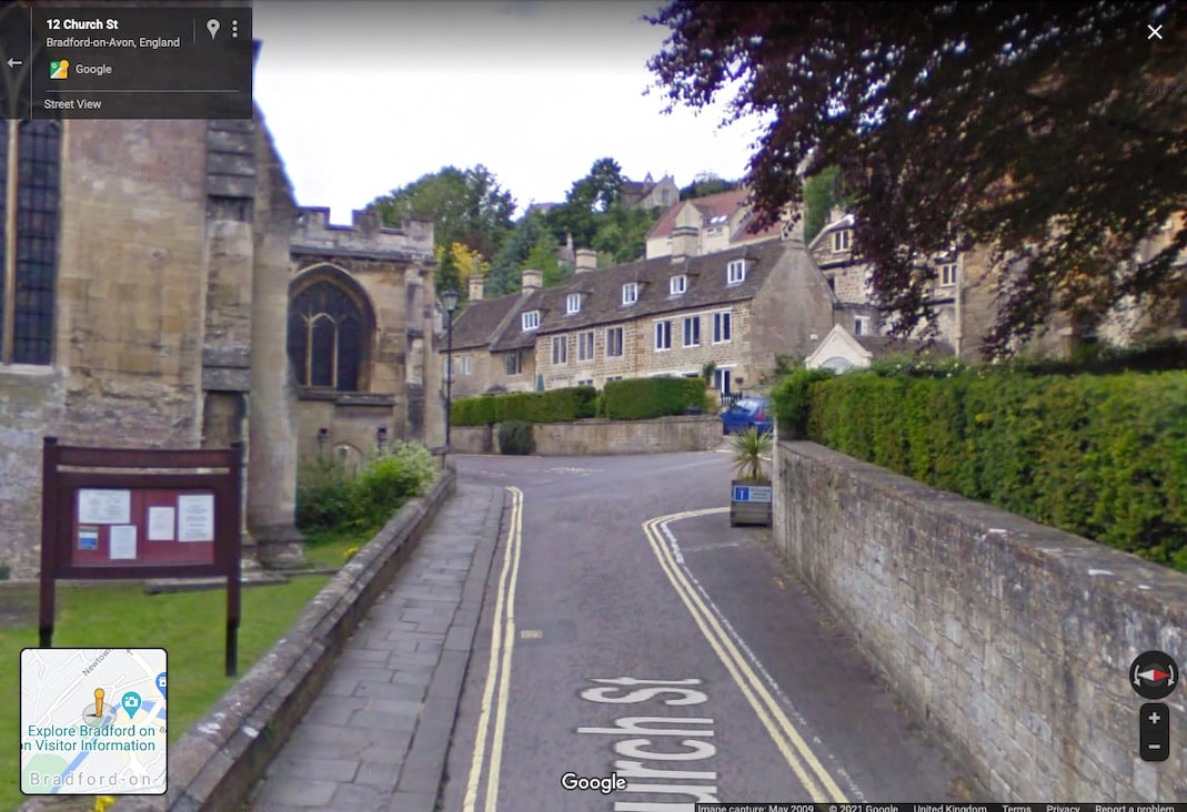
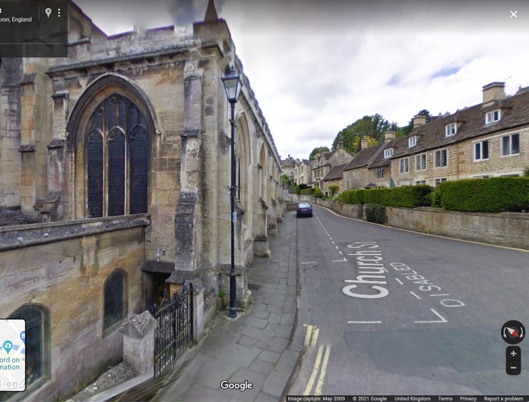
Below is a view of Church street and below that is the same view in 1011.
Above we see a large ditch surrounding the parish church that helps prevent flooding in heavy rain. The Normans demolished and then rebuilt the parish church. It then gradually developed and expanded into the Holy trinity church we have today. Over the centuries, (due I think to land sell offs) the church yard was becoming smaller and smaller. At some point the ditch disappeared, with the ground subject to many burials, before the road was built on top of it. With the ditch gone, Trinity church was then, as it is now, subject to damp and flooding from heavy rain coming down from the aquifers in the hillside.
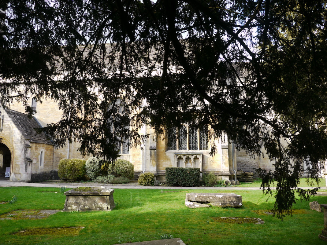
Below is a photo of Trinity church looking north from the church yard.
Below that is the same view in 1011.
Below that is the same view in 1011.
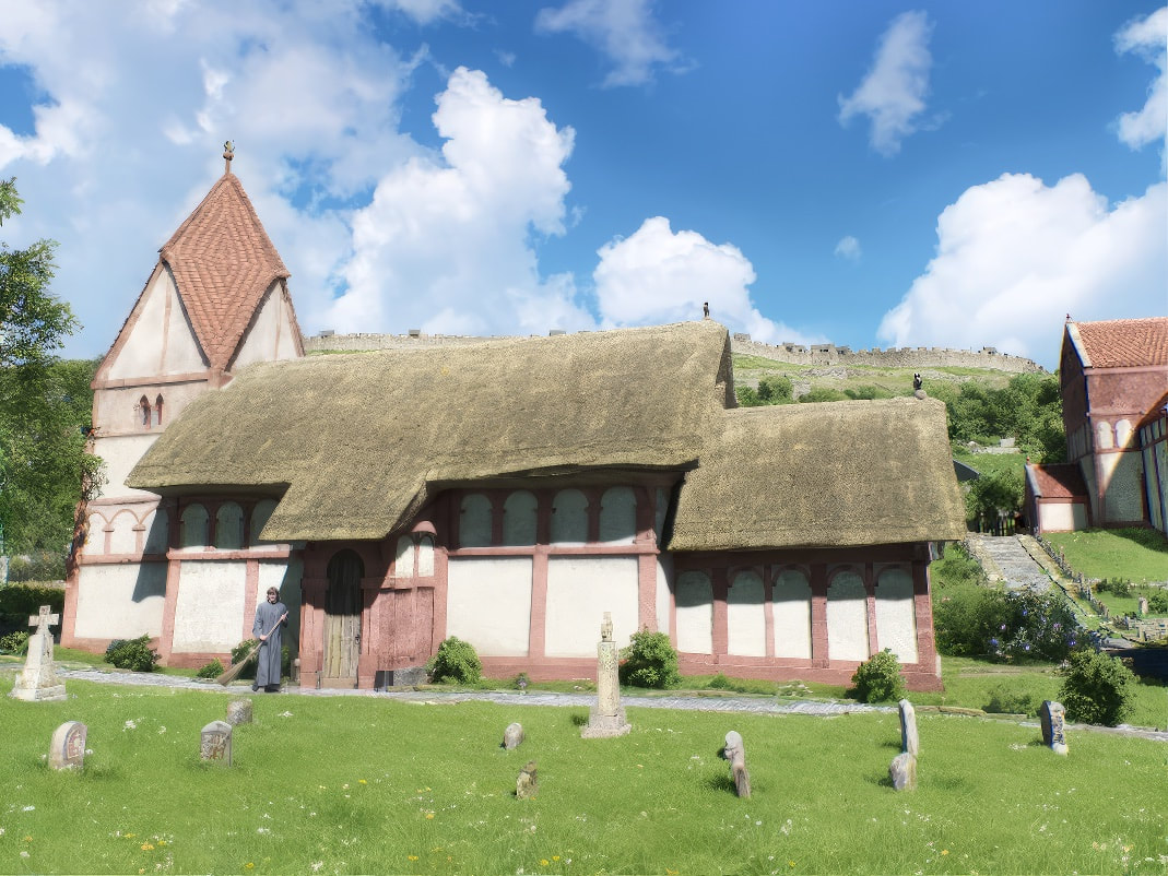
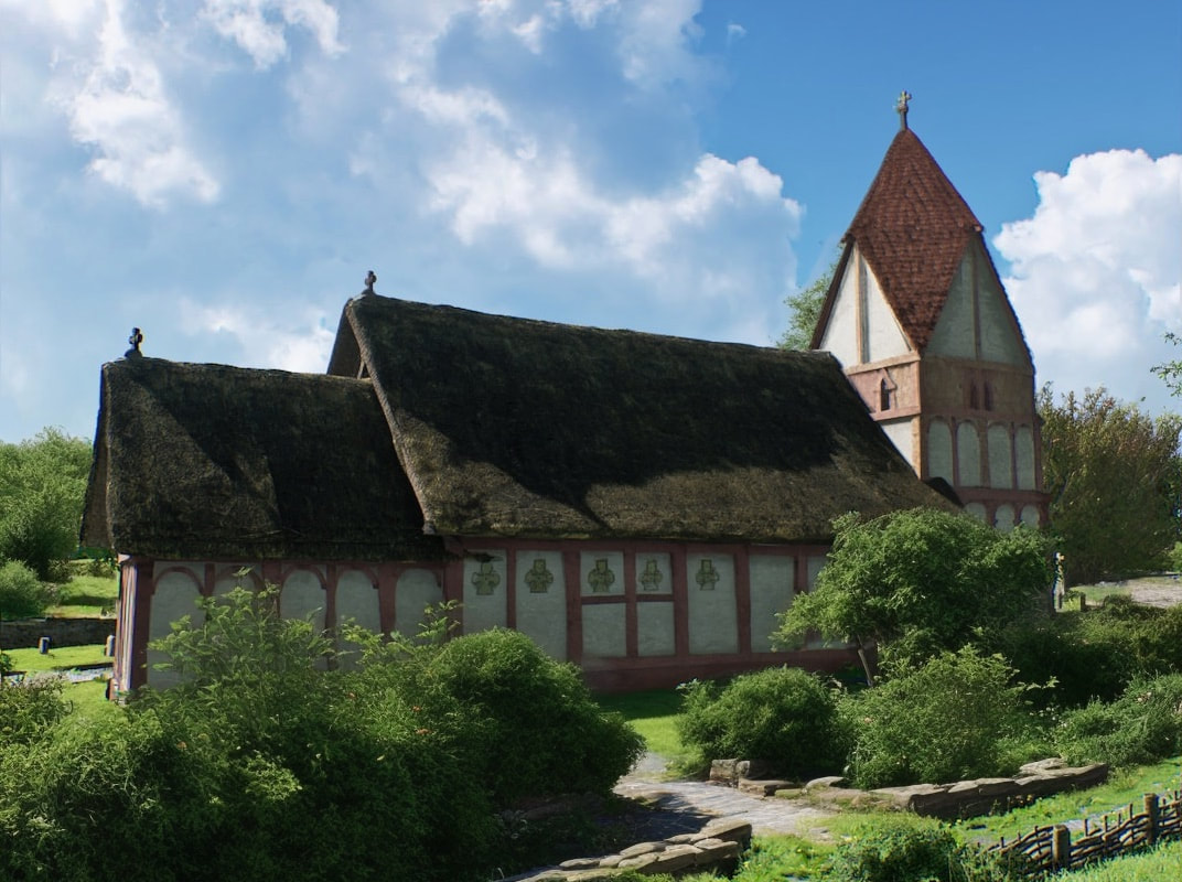
Above is the parish church. Very little is known about it except for its orientation. So here's what I think is the most likely generic Anglo-Saxon Parish Church. The tower's roof is based on the Saxon church at Sompting in West Sussex, who's Tower was built in 1050. It's such an elegant solution to roofing a tower, intuitively I think there must've been quite a few others that preceded it. Our parish church looks wooden, but is actually made of stone in the faux wooden style of the St Lawrence church and many other Anglo-Saxon churches. Except for the porch, which isn't involved in an act of worship, so is made of wood.
Below is a Google Street view photo of Trinity church looking west from Church street. The road we see today has been raised using cut and fill to make it level, where once there was a slope.
Below that we see the slope from the same view in 1011.
Below that we see the slope from the same view in 1011.
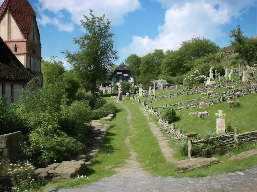
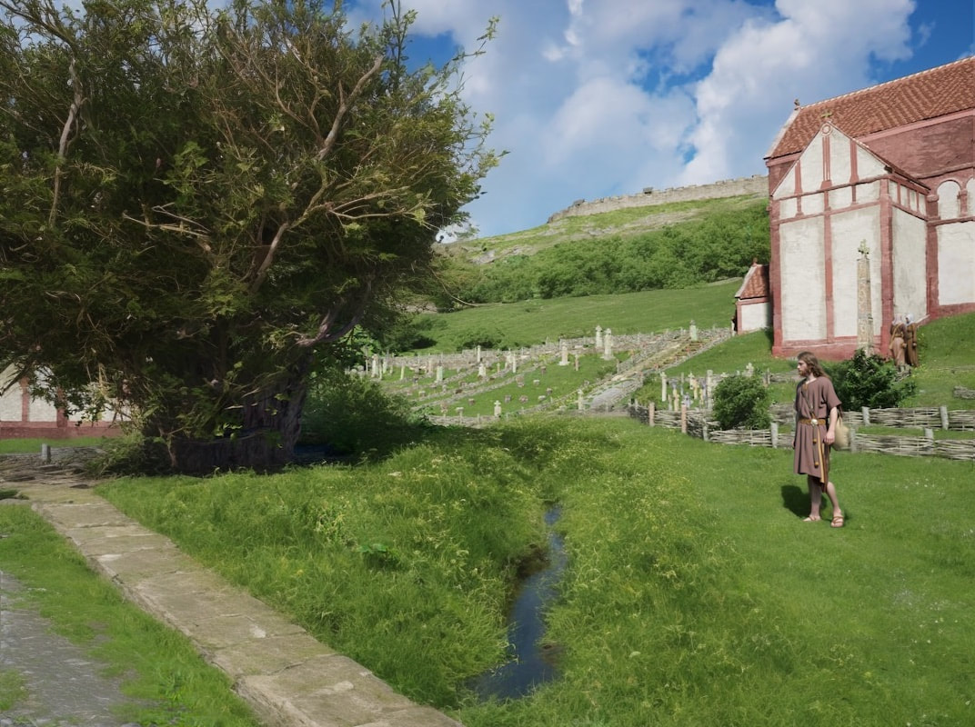
Above we see to the left of the church yard path the ditch. The parish church and churchyard has a different east west orientation to the current Holy Trinity church. This Anglo Saxon church and churchyard layout, shared the same orientation as the church of St Laurence (The Saxon church). A dig by Wessex Archeology in 2016 revealed this, when they uncovered the graves of a family that lie a couple of metres behind the woman pictured standing in the distance, in the pathway in this image. We also see the graveyard is segregated into family plots, and plots that reflect someones position in society. In the background is the priests house.
Below is a photo showing Trinity church looking south west from Church street.
Below that is the same view in 1011.
Below that is the same view in 1011.
Above we see the north side of the church and a little more of it's protective ditch.

Above is a postcard shot I couldn't resist :) Taken a little way out in the river. It includes the water meadow between the church and the river, the parish church, the church of St Laurence (the Saxon church) and high up on top of the hill, we can see Budbury hill fort.
