The area of Elmfield, Churches & Downs View
Getting things from the valley to Budbury Hill fort was hard. Much harder than the simple level walk from Churches and Elmfield that are already at the top of the hill. I think the main sources of income in the valley were fine crafts and the clergy, whereas, here, on the gently sloping plain just north of the hill fort, it was agriculture.
Below we see a rather lazy pack mule drover in 1011, navigating the bend in Conigre with the steep drop behind him, and below that is a photo at a slightly different angle of how the bend looks today.
Below we see a rather lazy pack mule drover in 1011, navigating the bend in Conigre with the steep drop behind him, and below that is a photo at a slightly different angle of how the bend looks today.
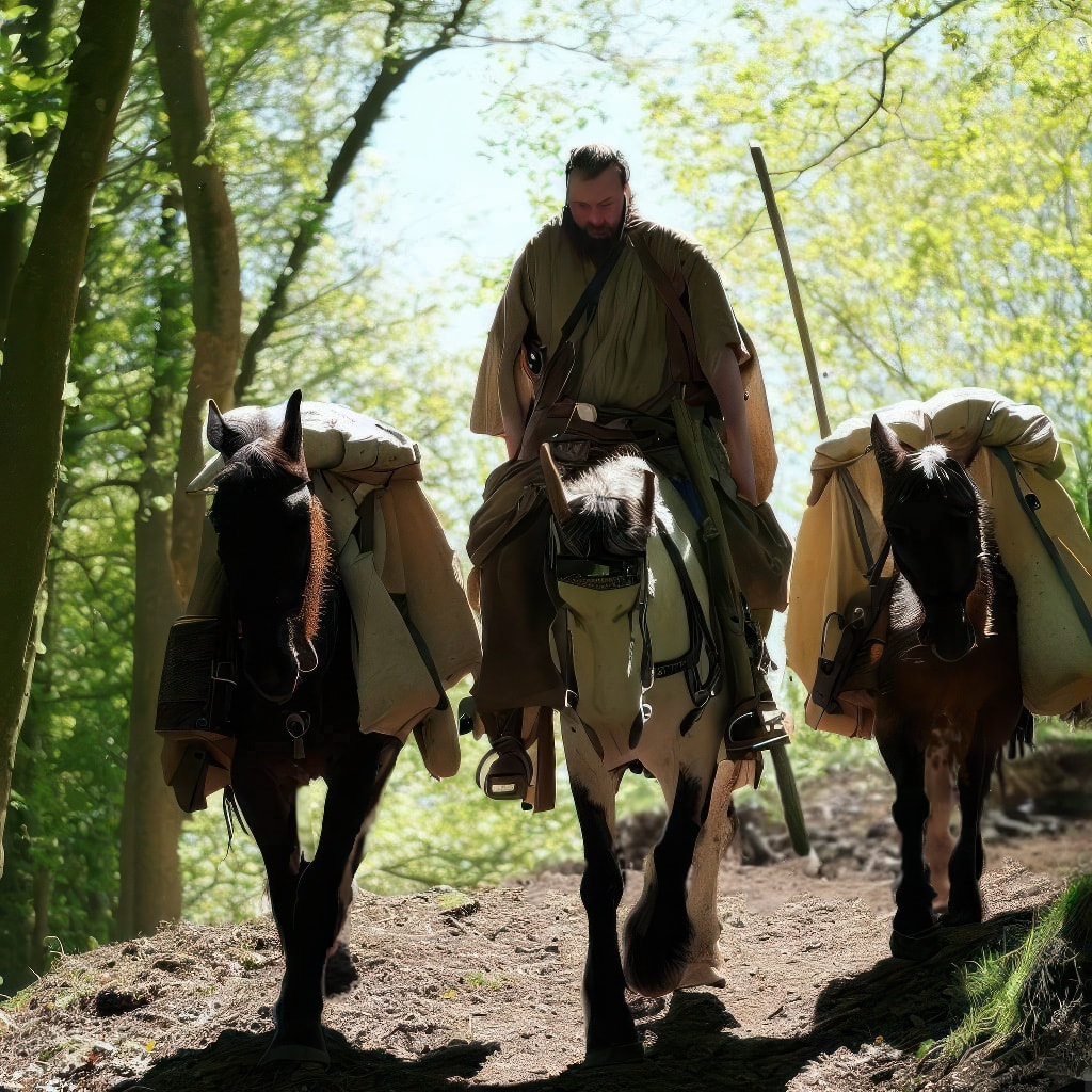
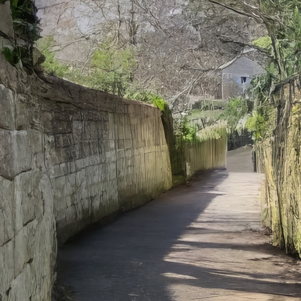
Photo Published with the kind permission of Bradford on Avon museum
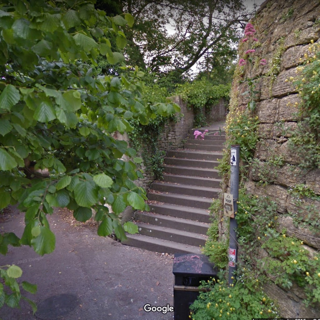
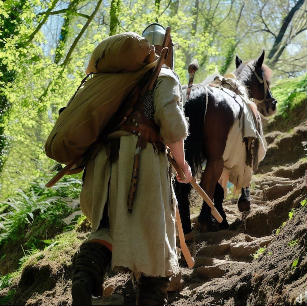
And it was even harder to get stuff up Wine Street, being steeper, it was likely just a service Path for the fort. Newtown was yet to be constructed, so Wine Street would have come straight down into Barton Orchard. Below is a Google Street view image where roughly I think Wine Street connected with Barton orchard, and below that, is a soldier in 1011 starting up the hill from around the same spot.
So the advantage Churches and Elmfield had was that it's large area of fertile agricultural land, could supply the daily needs of both the hill fort and the valley (going downhill was much easier) with food. According to the Domesday book, over 90% of the population of England were involved in agriculture, so I think the largest part of the population of Bradford in 1011, lived here, at the top of the hill.
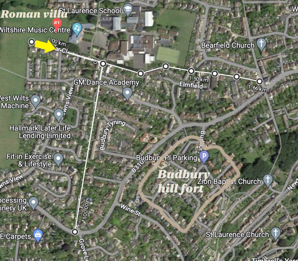
Below is a Google map of the area. The straight lines that I've drawn using the measuring tool are streets that form the Roman extension to this settlement. Our main road of interest starts at the yellow arrow near the Roman Villa and Wiltshire music Centre, going straight along the Roman road Westward and then the more meandering pre-Roman road takes over, taking us to Huntington Street and the top of Conigre Hill. (All routes I've drawn follow the old Field boundaries). If you look at the whole map, it looks like all these roads form a civilian detour, so that the part of Winsley Road that passes Budbury Hillfort could be made into a military zone only. In 1011 this ruthless military efficiency has long gone and we stand where the yellow arrow is, looking west. Scroll down to see the view from the spot as it is today.
Below is a Google map of the area. The straight lines that I've drawn using the measuring tool are streets that form the Roman extension to this settlement. Our main road of interest starts at the yellow arrow near the Roman Villa and Wiltshire music Centre, going straight along the Roman road Westward and then the more meandering pre-Roman road takes over, taking us to Huntington Street and the top of Conigre Hill. (All routes I've drawn follow the old Field boundaries). If you look at the whole map, it looks like all these roads form a civilian detour, so that the part of Winsley Road that passes Budbury Hillfort could be made into a military zone only. In 1011 this ruthless military efficiency has long gone and we stand where the yellow arrow is, looking west. Scroll down to see the view from the spot as it is today.
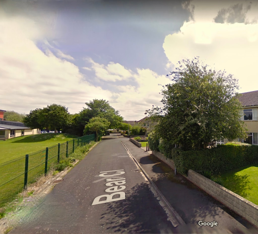
Below is Bear close with St Lawrence school to the left and below that is an image of how I think the same scene may have looked in 1011.

Above, we look along the full length of the Roman part of the road. To the left we see the stone remains of the old Roman villa's chapel, now forming the unusually thick Boundary walls of a garden. Still on the left side of the image, further, right out into the distance, we see, at the far boundary of a Wheat field, the gently rising Huntington Street. To the right of that we see the pre-Roman road going off between the trees on its way to the top of Conigre hill. The topography of this scene is accurate, but the buildings (all made of wood) are generic, based on what we know of vernacular architecture at the time and they allow us to get a general idea of how the scene would look and feel. On the right side of the road are some substandard homes of slave families (Servi) and on the left by contrast are a couple of the homes of cottagers ( cotarii). There's also a small boy in the middle distance, who's been collecting the immature acorns that fall in the summer.
