Hangdog Alley & The Lost Druces Lane
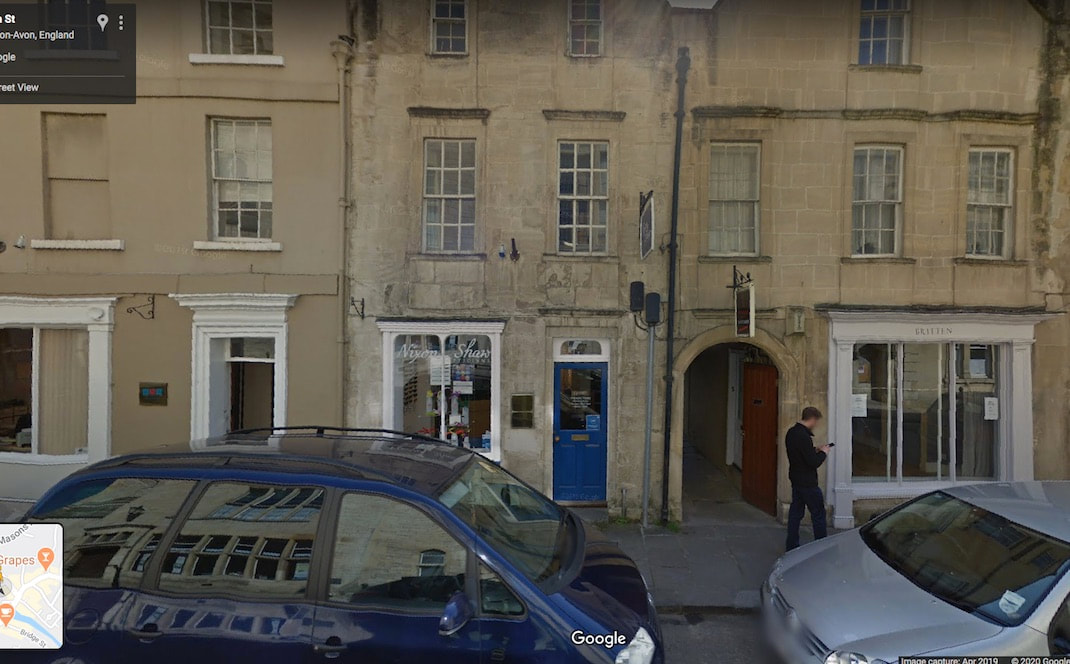
Below in the Street view image we're in Church street and you can see the arched doorway to Hangdog alley on the right. I think the original lane came out into Church street a little bit to the left of that, as illustrated in the
bottom image of the same view of what I'm calling Hangdog lane in 1011, where you can see it running straight to the river.
bottom image of the same view of what I'm calling Hangdog lane in 1011, where you can see it running straight to the river.
|
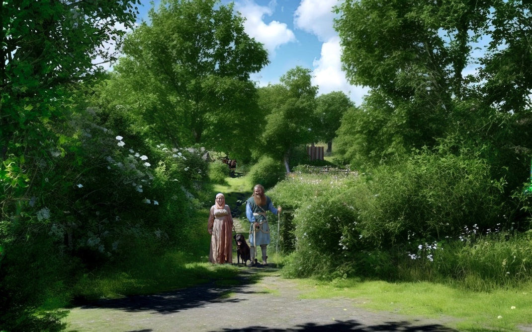
People in the image
If you really did go back and visit. Meeting the people would be fascinating. Understand them & how they lived their lives, plays a large part in reconstructing where they lived. |

|

|
If these two people are brother and sister with many years between them, as the five siblings that were born in between them, have all died in infancy. That would be much more common in 1011, than 40.5 generations later in 2023.
Anyway :)
Hangdog alley today has this bend in it, because half way from the river to Church street, the old packhorse width lane was narrowed and diverted to become an alley between the new houses. The river end of Hangdog alley is still packhorse width though and follows the original trajectory.
Hangdog alley today has this bend in it, because half way from the river to Church street, the old packhorse width lane was narrowed and diverted to become an alley between the new houses. The river end of Hangdog alley is still packhorse width though and follows the original trajectory.
The lost Druces lane
Below is an image from Google Streetview of church Street.
Below that is the same view in 1011.
Below that is the same view in 1011.
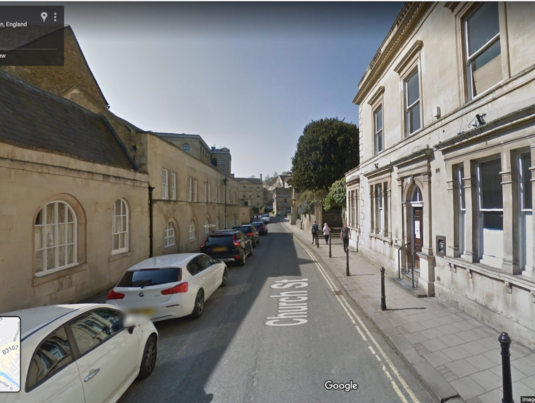
Above, there it is on the right. The lost Druces Lane which is actually part of the then main road through Bradford and out to Belcombe Road. In the image, the left fork turns off the main road to what is now Church street.
|
The heavy goods route.
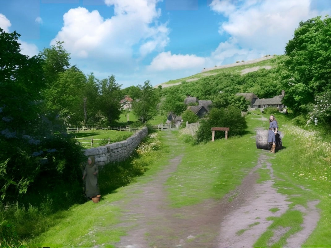
In the above picture, we see a man (also pictured right) Rolling a barrel a third full of water from the river end of Hangdog Alley, up the slight slope to the back of the pub, where close by is a small community of crafters. This seems like a fairly likely route into town for heavy and dirty goods, like large construction timbers and dirty blacksmiths charcoal, all rafted down the river. Opposite hangdog Lane, where the old Town Hall is, I think is the most likely site for a Timber yard. In the picture above a left turn takes us off the main road and we pass the little girl picking elderberry flowers in the shade by the wall (also pictured right). This road takes us on to the inn and market, the Ford and the port. I think it was very likely that a packhorse rest area would be there too. And this area is the subject of our next chapter.
|


|
But before that
|
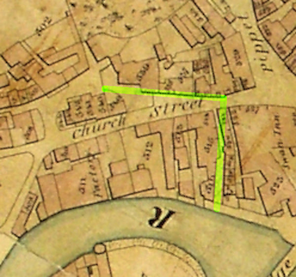
This is the heavy goods route mapped. On the right is the 1837 map before the building of the town hall & all the banks, and it's the best map to show how Hangdog lane and Druces lane (both marked in yellow) formed the heavy goods route. If we take heavy goods Down church Street we're going downhill and then we have to haul it up Druces hill. If we land them at the Ford, we make a mess & they still have to go up Druces Hill.
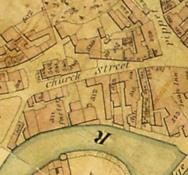
Another look at the 1837 map without the highlighting, showing Church street before the building of the banks and the Town hall (now the catholic church). We can see the previous buildings still followed the line of old Druces lane, even though, (as seen by the boundary lines,) by then it had fallen out of use and was no longer passable
|
|
|
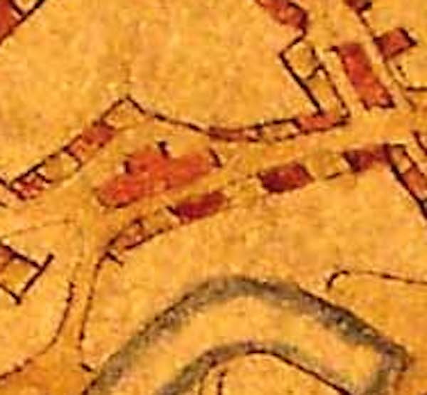
If you want to see a map with Duces lane on it. On the right is a part of the 1767 (earliest original) map of Bradford showing Church Street. And it looks like, at that time, Druces lane was open and unobstructed.
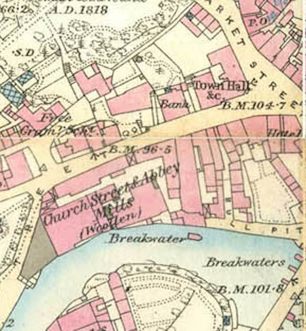
By contrast, on the right you can see Church street from the 1887 map of Bradford, showing it pretty much as it is today, with the old banks and the Town hall.
|
|
