About
Virtual model
Bradanforda be Afne is a virtual model of Bradford on avon in 1011. A few years after the completion of the Saxon church. A time chosen because the town would've had an every day normal appearance. Where as, at the opening of the brand-new Saxon Church (Saint Edward's reliquary) the whole town centre would've been tarted up for the king's visit.
Method
I used the 1 metre resolution LIDAR scan of Bradford, plotted the location of all the relevant archeology and then manually removed the buildings. The slopes of Bradford have been largely terraced so they can be built on, so I then restored the natural topography to something that looked credibly eroded by wind and water.
East West route
In the iron age, the river is thought to have been a frontier. So I flooded the river and plotted a route so it could be patrolled east to west at any point near the river, on the most gentle slopes, just comfortably above both the maximum recorded flood level, and the maximum flood level I could create, that used up all of the flood plain. I've illustrated the resulting route here on a Google map below.
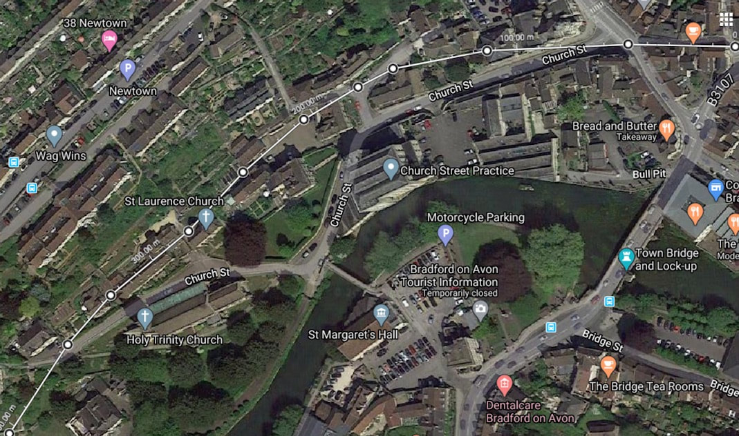
I then included the mundane but vital open drainage needed to support all the assets like the Saxon church, the excavated wooden house, the Anglo Saxon port and ford etc. In doing so, the historical street plan spontaneously emerged as the obvious routes to navigate anywhere from a to b. This then determined many of the land plot boundaries.
I think Anglo Saxon Bradford looked much like the Saxon church,
but in wood.
Below is a shot of the inside of the Saxon church looking towards the alter. If you look at the course of stone at the base of the walls (You could describe it as the stone skirting board :) in this picture. You’ll notice it’s not level, but is sloping, (high on the left and low on the right), and more closely follows the slope of the underlying terrain.
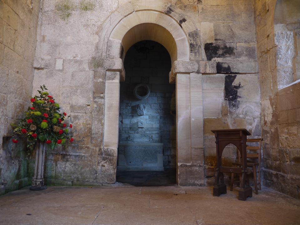
Why didn't they do what we would do, and build a level building from a level plinth?
Well, the Saxon church is a stone building trying to look like a timber building with posts and rails. it's showing us how those old timber buildings were constructed, and that it was normal, acceptable common practice, to not level the hillside, but do the best you can at levelling and then let the floor plate rest on the slope of the hill. You then build a level floor inside. There's a further clue to this outside. As you can see these rails between the chancel and naive, don't meet up here on the south side, but they do on the north side. That's because the slope under the Chancel is less steep than the slope under the Naive.
Well, the Saxon church is a stone building trying to look like a timber building with posts and rails. it's showing us how those old timber buildings were constructed, and that it was normal, acceptable common practice, to not level the hillside, but do the best you can at levelling and then let the floor plate rest on the slope of the hill. You then build a level floor inside. There's a further clue to this outside. As you can see these rails between the chancel and naive, don't meet up here on the south side, but they do on the north side. That's because the slope under the Chancel is less steep than the slope under the Naive.
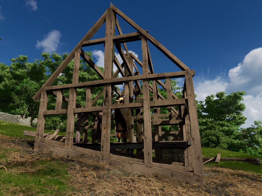
So let's go to a construction site
to view this slope clinging building technique
to view this slope clinging building technique
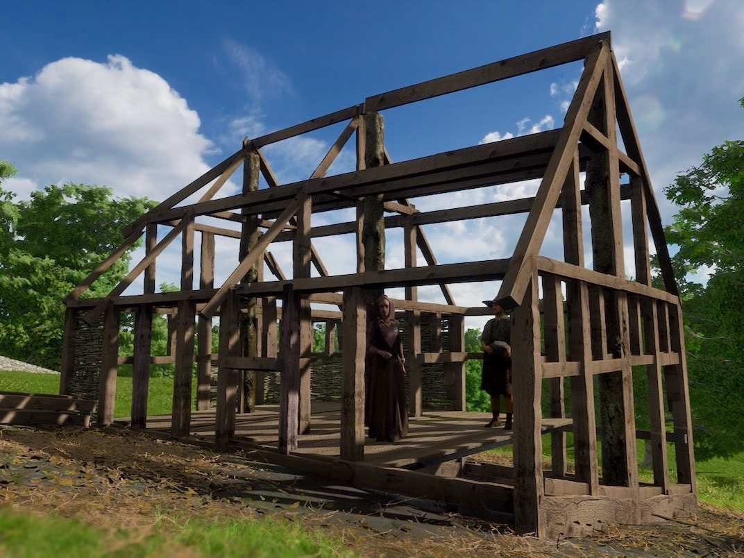
In the picture above you can see a level floor is created using carpentry, rather than moving tons of soil to create a level building plot. Instead, that weight of soil is holding the structure solid, via 3 large posts wedged into deep stone lined holes. The house frame is then built around these solid secure posts. Thus, the Anglo Saxons largely avoided the constant maintenance associated with the retaining walls that are usually needed to create a level plot, on sloping ground.
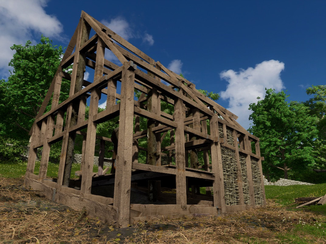
Above you can see some wattle infill, waiting to be covered in daub plaster to create the panels between the timber frame, and also help brace the entire structure.
Adrian Powell
Archaeologist Adrian Powell's advice was grounded in a deep knowledge and a good appreciation of the possible certainty of each piece of info. I had numerous conversations with him when I was developing the project. He agreed with some of my ideas, but totally destroyed many of them (because he had often actually dug up the area I was talking about, or performed a watching brief, which involves looking into any holes routinely dug to maintain or install underground cables and pipes etc) and he left me with a much more restricted set of options, which was incredibly helpful, and made much of the project possible.
Archaeologist Adrian Powell's advice was grounded in a deep knowledge and a good appreciation of the possible certainty of each piece of info. I had numerous conversations with him when I was developing the project. He agreed with some of my ideas, but totally destroyed many of them (because he had often actually dug up the area I was talking about, or performed a watching brief, which involves looking into any holes routinely dug to maintain or install underground cables and pipes etc) and he left me with a much more restricted set of options, which was incredibly helpful, and made much of the project possible.
