Ladywell Stream
Ladywell stream was a huge asset to Bradford on Avon in 1011, You'll possibly be able to guess where the shot below is, a bit later on.
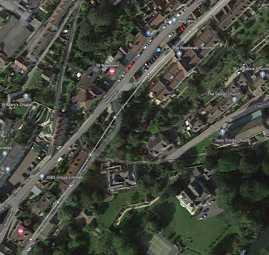
Below we can see on a Google map that Newtown is clearly marked. A bit further down the hillside, I've drawn a white line that shows the route I think the original road took, that was there before Newtown was built. As you can see, I think the old road included Barton orchard and the Rope Walk.
|
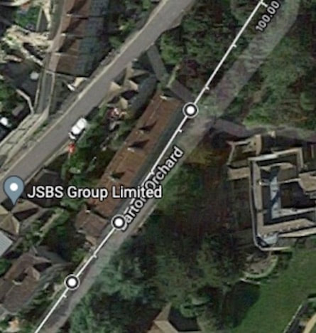
On the right, if you look closely you can see the weavers cottages in Barton Orchard are built on an old building plot who's boundary is parallel to this old road and not to the current later route.
|
|
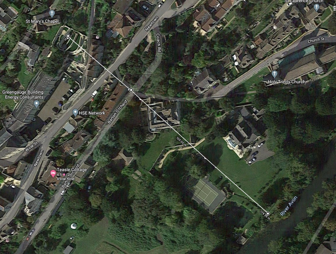
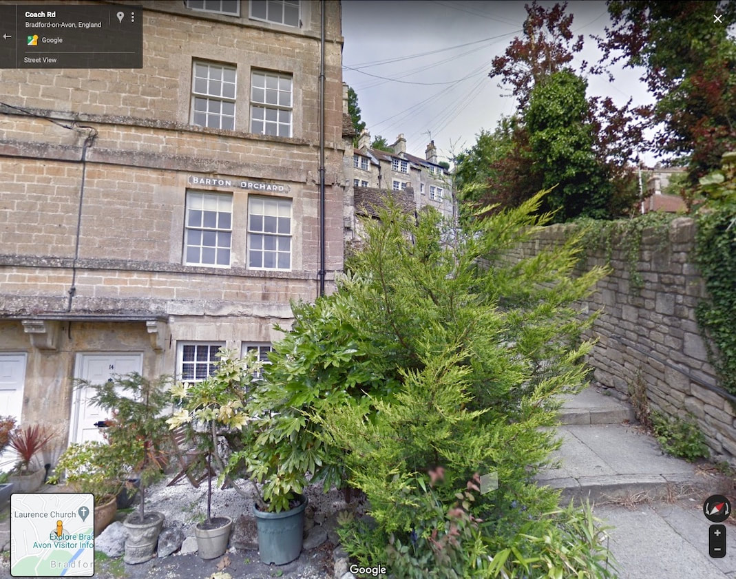
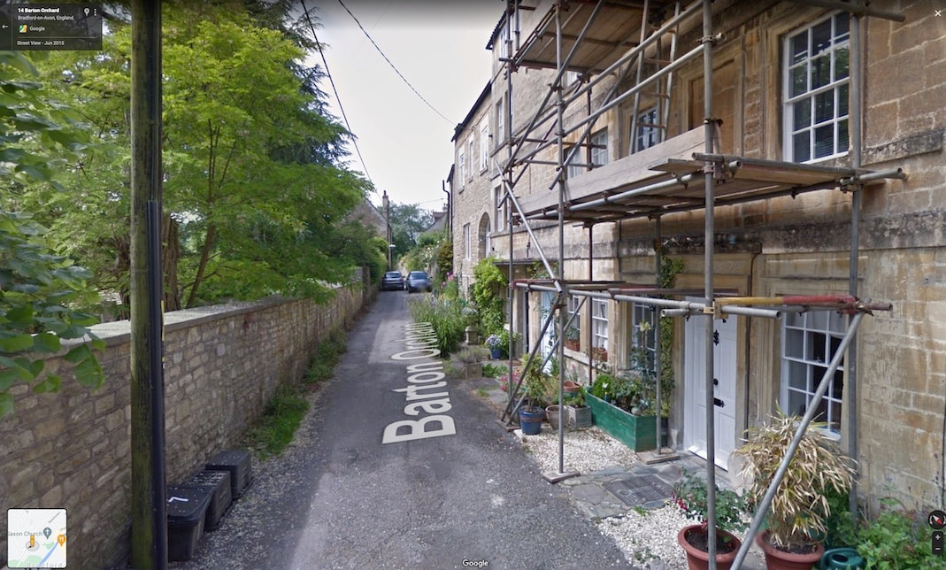
In the Google Street map view below, we can see the route of this old Road is crossed right next to Barton Orchard weavers cottages, by what I think is the original route of the Ladywell stream. The white line indicates what I think is quite close to the original working route of the stream (before diversions) from its source, just below Saint Mary's Tory, through Newtown, all the way past the old vicarage to the river Avon.
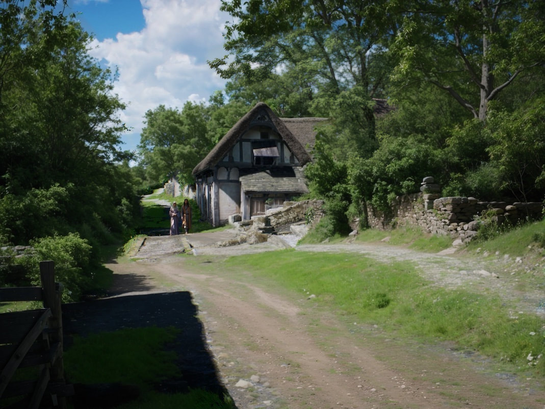
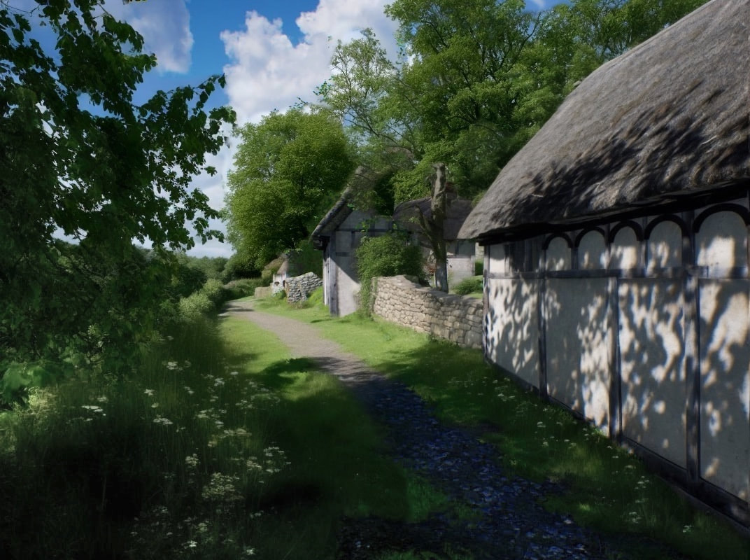
Below, unfortunately obscured by a bush in this Google Street view image, is a gap between the end weavers cottage on the left and Barton steps on the right. I think this gap (due to its alignment with the straight route shown above, from Ladywell, down to the river Avon) is the old route of the working Ladywell stream. The image below this one is how I see the same scene in 1011.
The rise is not so steep as today because Newtown wasn't built. Part of Newtown juts out from the natural hillside, making the ascent from here today, steeper.
The stream follows the likely old Roman straight conduit where a small collection of businesses and a large number of people can collect water throughout the day, as you can see by how wet and worn the cobbles are.
The stream follows the likely old Roman straight conduit where a small collection of businesses and a large number of people can collect water throughout the day, as you can see by how wet and worn the cobbles are.
In the picture of Barton orchard below, I can clearly see the main thoroughfare of Barton Orchard do has been truncated and blocked off, (this old road was replaced by the far superior "bypass" of Newtown further up the slope.) The picture below this one is how I think the same view looked in 1011.
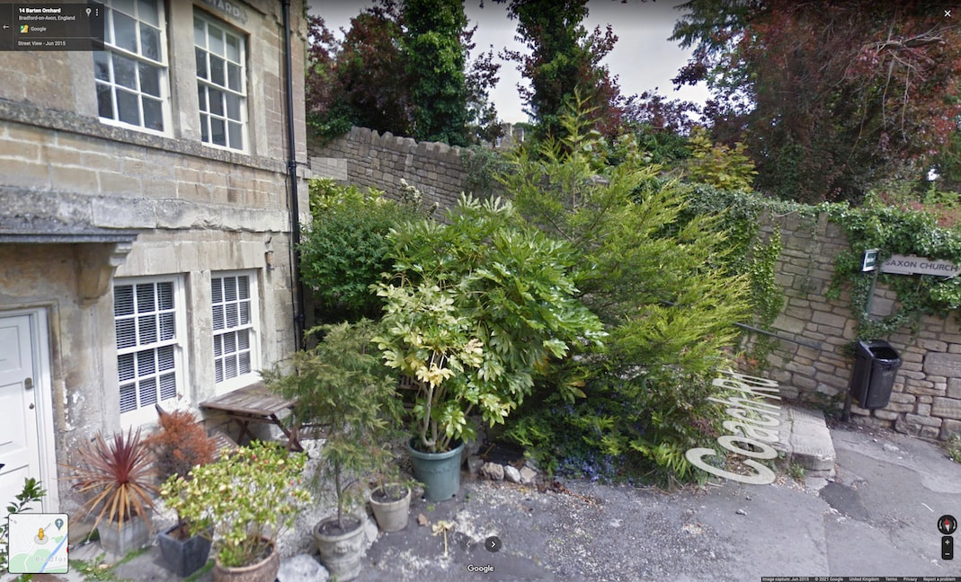
Here the road level is about a meter and a half higher than today, as the old road which has slowly ascended to join up with the Rope Walk. Whereas, today Barton Orchard is a fairly level cut and fill terrace.
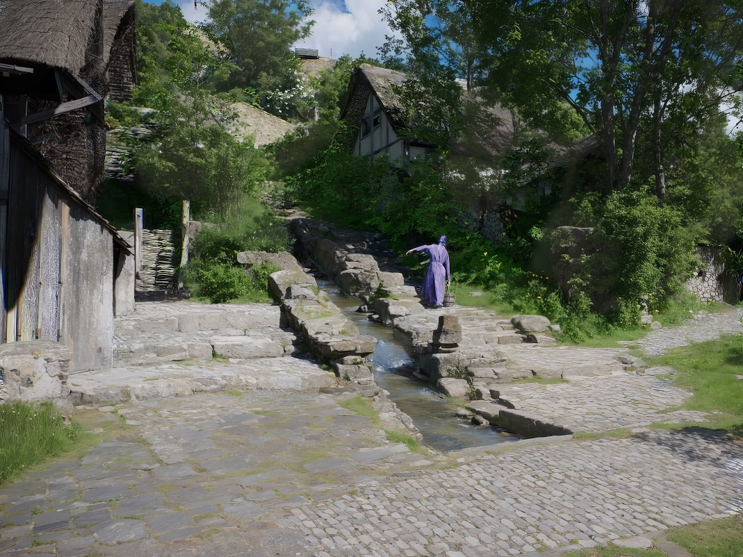
This route would've been very busy with people and animals carrying pales of water. When Newtown was built I think they used this old road as a service road for construction. When completed, Newtown rendered this old road obsolete, by providing a flat wide straight road for horse and carriage, but also Incorporated underneath it was a lead pipe carried bought it all the way to market Street, and replaced all those hand hauled pails bringing the clean water of lady well to all of Bradford. In the picture above you can see they're still struggling with their buckets :) And they'll have to struggle for a few hundred years more. The man in the foreground has a Bucket inside a wicker basket to make it easier to carry so we can hold it close against his body over a long distance.
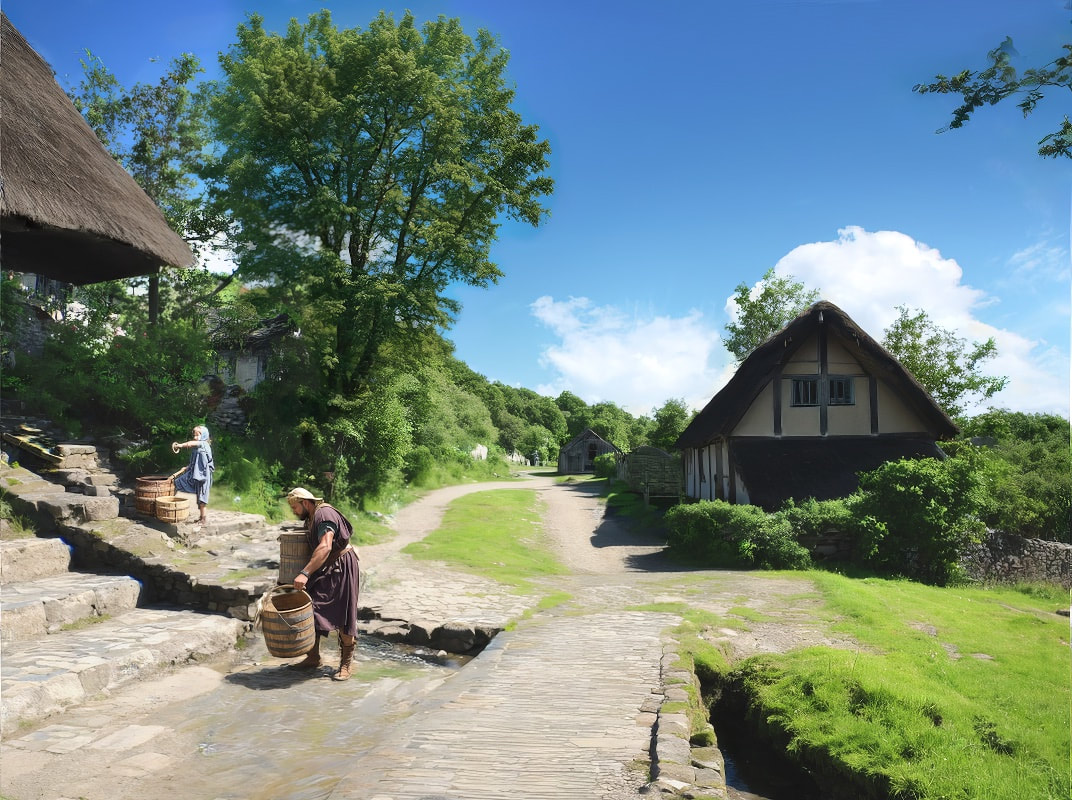
Below is a Google Streetview of Barton Orchard looking West, and below that is the same view as I think it looked in 1011.
I don't think Barton Orchard wasn't a flat Terrace like today, but a gently rising slope. Where generic Single storey, Anglo-Saxon detached buildings cling to the hillside, all facing very slightly different directions. They do this to best catch the westerly wind, that blows through the western wind hole (window), in the gable ends of their homes as it carries the smoke from the open fire that was in the middle of the main room, through the rafters and out the Eastern wind hole. Buildings are both spaced and orientated so that your smoke isn't drawn into your neighbours house.
Next, After taking in a birds eye view, we'll go down this road, on our way to Ladywell and Budbury hillfort.
